25 oktober 2013
5 minuten
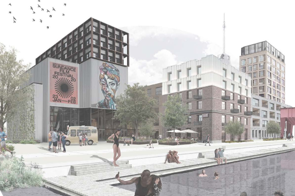
Nieuws The Amsterdam Metropolitan Area is becoming fuller and fuller, but space for development is scarce so it has to be sought at new locations. Over the coming decades the banks of the IJ inlet, River Zaan and North Sea Canal will be transformed from industrial, extensively used port areas into intensively used metropolitan live/work areas. The economic uncertainty is great, however, and social developments are difficult to predict. This calls for a two-pronged plan of attack: keep a close eye on developments and employ a broad planning framework that makes it possible to respond flexibly to changes.
Transforming dockland areas
Lessons learned from "Urban Development on the Waterfront"
- The transforming plan for the dockland areas is two-pronged: keep a close eye on developments and employ a broad planning framework that makes it possible to respond flexibly to changes.
- Crucial in transforming dockland areas is the search for a common goal and improvements that benefit all the parties concerned, instead of a struggle between the authorities and industry.
- The modification of the noise contours in Port-City allows a more efficient use of the space.
Vision for the North Sea Canal Area
The North Sea Canal Area fulfils an important
role within the metropolitan region, as the
home to business parks, urban live/work areas
and green space where people work, live and
spend their leisure time. Local, regional and
national governments developed an integral
vision in order to retain and enhance these
diverse qualities for the future.
The Visie Noordzeekanaalgebied 2040
(Perspectives for the North Sea Canal Area
in 2040) focuses on the area’s sustainable
development as an economic powerhouse, with
intensification as the basic principle. Several
preconditions, the noise contours included,
are being modified in order to allow a more
efficient use of the space. This is a means of
bringing living and working closer together
and frees up more space for the desired metropolitan
residential milieus.
There is also consideration for intensification
and improvement in the quality of
the existing landscape as well as nature and
recreation areas. Green space and other
functions will be combined where possible,
by bringing green developments into the port
area, for example.
In the autumn of 2013 the parties will
begin working in concert on an implementation
agenda. The agreements about monitoring
what actually happens in the area and in the
world at large are an important aspect of this.
In addition, since the formulation of the vision
there has been an ongoing dialogue with the
business community, local residents and social
organisations. The vision provides the stability
of a fixed outline, and within this it possible to
respond in concert to the opportunities that
the future brings.

Because of developments along the IJ waterfront, this waterway is assuming a more central position within the city of Amsterdam. Picture courtesy of Edwin van Eis
‘Urban Development on the Waterfront - Afbeelding 1’
Port-City’s transformation
Port-City is designated as a transformation
area in the Structural Vision: Amsterdam 2040
long-term strategy. This section of the port lies
within the Ring A10 orbital motorway and is
just a 10-minute cycle ride from the city centre.
This area along the IJ’s northern and southern
banks, and pushing out from the west side of
the city, will be transformed step by step over
the coming years. This thrust will emanate from
the Sloterdijk multimodal transport hub, where
plenty of office space stands vacant.
Until now these offices could not be
converted into dwellings, because of the
statutory noise contours of the Westpoort
harbour area. However, research has revealed
that these contours can be tightened, as the
businesses in this part of the port produce
much less noise than is permitted. Modification
of the noise contours in Port-City will make
it possible realise up to 9,000 dwellings and
accommodate up to 38,000 jobs through to
2040.
The coming years will see the initial steps towards the area’s gradual transformation, while ensuring its quality and rallying public support. In 2025 the City Council will decide whether the Coen- en Vlothaven dockland area is to be transformed as well. If that is the case, then in 2040 Port-City will be able to accommodate 20,000 dwellings and 44,000 jobs.
Living and working in the ZaanIJ area
Zaanstad has 30 kilometres of waterfront and is
attracting residents and businesses with innovative
combinations of metropolitan living and
working. The banks of the Zaan and IJ waterfronts
are being jointly developed by Zaanstad
and Amsterdam, with the support of national
government. The ZaanIJ programme assumes
the realisation of 30,000 new dwellings (with
about a quarter of these in Zaanstad) and the
creation of 30,000 jobs over a 20-year period.
Zaanstad Municipal Council has selected
four locations for accelerated development:
the Hembrug Terrain, the environs of the
Wilhelminasluis lock complex in the heart of
Zaandam, the Hemmes peninsula close by
Zaanse Schans and lastly Noordzaan, an area
surrounding two factory complexes. For the
first three locations the municipality is directly
involved; for the latter it has produced a coherent
vision to coordinate with existing initiatives and
inspire new ones.
A significant proportion of the job creation
in the ZaanIJ area is being sought in creative
and innovative sectors, as well as in services,
care, recreation and tourism. At the same
time Zaanstad is maintaining its focus on manufacturing
industry, which has made the region
great and continues to be a strong presence.

Investing in the natural and recreational qualities of the North Sea Canal Area is important in order to provide a counterbalance to urban pressures. Picture courtesy of Edwin van Eis
‘Urban Development on the Waterfront - Afbeelding 2’
The Monitor ZaanIJ survey was initially conducted in 2012 to gain insight into the development of the Zaan and IJ waterfronts. It revealed that the population, housing stock and employment there have increased considerably over the last decade. In addition, the type of business enterprise is changing: in the vicinity of existing urban areas there is an evident shift towards a smaller-scale business milieu with a large proportion of urban and creative services. The survey will be repeated in 2017.
Dialogue with businesses
A mix of functions is not yet possible at many
places in the ZaanIJ area, because the environmental
zoning means that people are not
allowed to live there. With the ‘Zaans Proeflokaal’
project – the ‘Zaandam Tasting Bar’ –
Zaanstad entered into an open dialogue with
industrial enterprises in order to address this
problem. This revealed once again that the
environmental zoning is overly generous and
is sometimes only partially utilised.
Because of the positive and broadly
supported outcomes of the ‘Zaans Proeflokaal’
project, Zaanstad now wants to apply this
modus operandi throughout the region. Crucial
in this regard is the search for a common goal
and improvements that benefit all the parties
concerned. It is not about a struggle between
the authorities and industry; it is about working
together towards making Zaanstad and environs
a place where it is more pleasant to work and
live.
Full text of the publication (in Dutch): PlanAmsterdam 6-2013
Cover: ‘2013.10.25_Urban development on the waterfront_1_660’


